JMC_C18_02052_001_001.jpg
Identity area
Reference code
FC-1-3-1-1-2052C18
Title
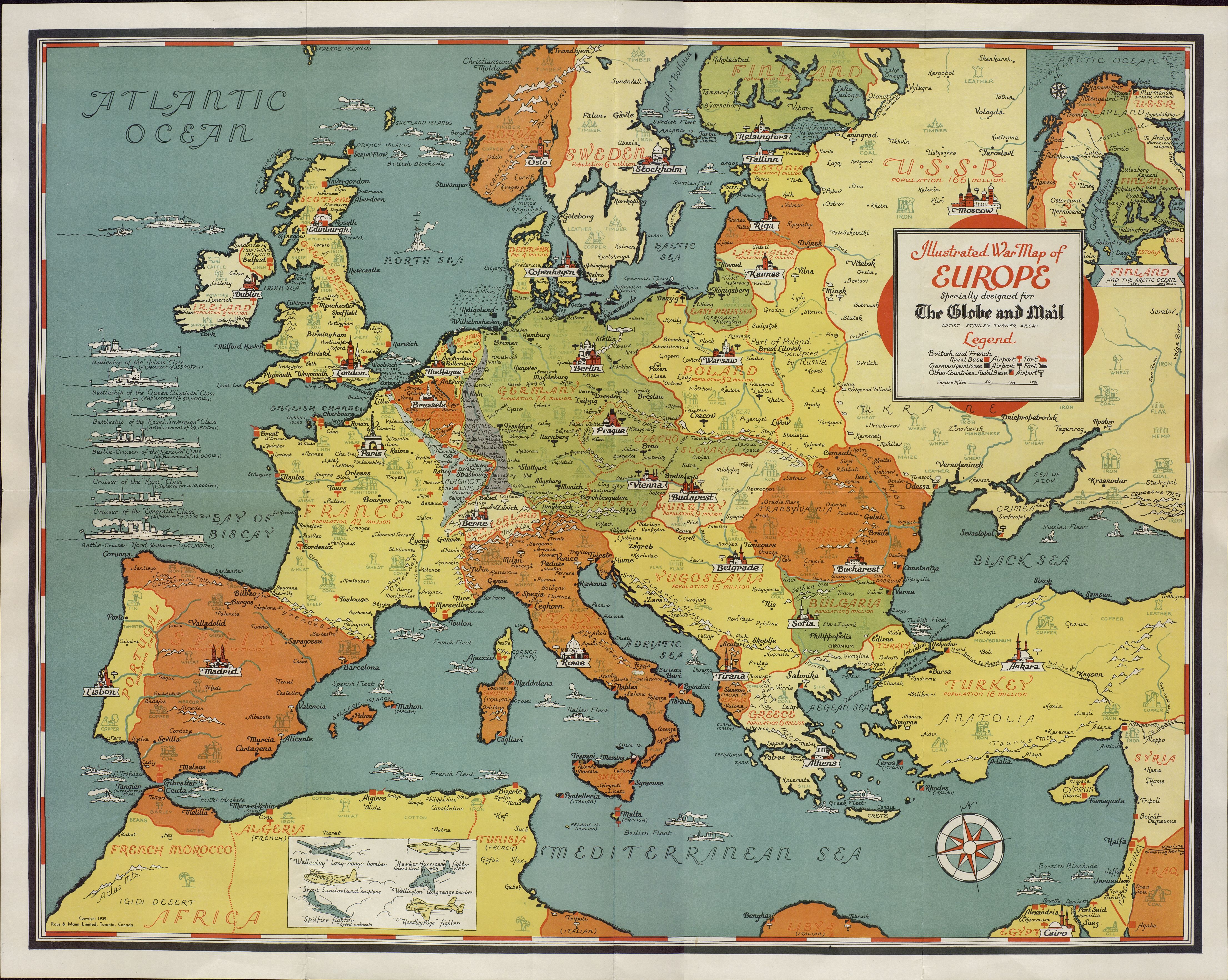
Mapa de guerra ilustrado de Europa. 1939
Date(s)
Level of description
Item
Extent and medium
Context area
Name of creator
Archival history
Immediate source of acquisition or transfer
Donación José María Castañé
Content and structure area
Scope and content
Mapa impreso en color, por una sola cara. Dibujos impresos en tinta negra. Título en recuadro en margen superior derecho, impreso en tinta roja y negra. Mapa político ilustrado de guerra diseñado para The Globe and Mail por Stanley Turner, que muestra Europa y la ubicación de las bases navales francesas, británicas y alemanas, así como sus aeropuertos y sus frentes. Cada capital está ilustrada con un monumento representativo. Incluye dos leyendas de barcos y aviones.
Appraisal, destruction and scheduling
Accruals
System of arrangement
Conditions of access and use area
Conditions governing access
Conditions governing reproduction
Language of material
- English
Script of material
Language and script notes
Physical characteristics and technical requirements
Medidas: 58,6 x 73,5 x 1 cm Conservación: Excelente
Finding aids
Generated finding aid
Allied materials area
Existence and location of originals
Residencia de Estudiantes-Madrid
Existence and location of copies
Related units of description
Notes area
Note
Illustrated war map of Europe. 1939
Alternative identifier(s)
Access points
Subject access points
Place access points
Name access points
- José María Castañé (Accumulator)