Identity area
Reference code
Title
Date(s)
Level of description
Extent and medium
Context area
Name of creator
Archival history
Immediate source of acquisition or transfer
Donación José María Castañé
Content and structure area
Scope and content
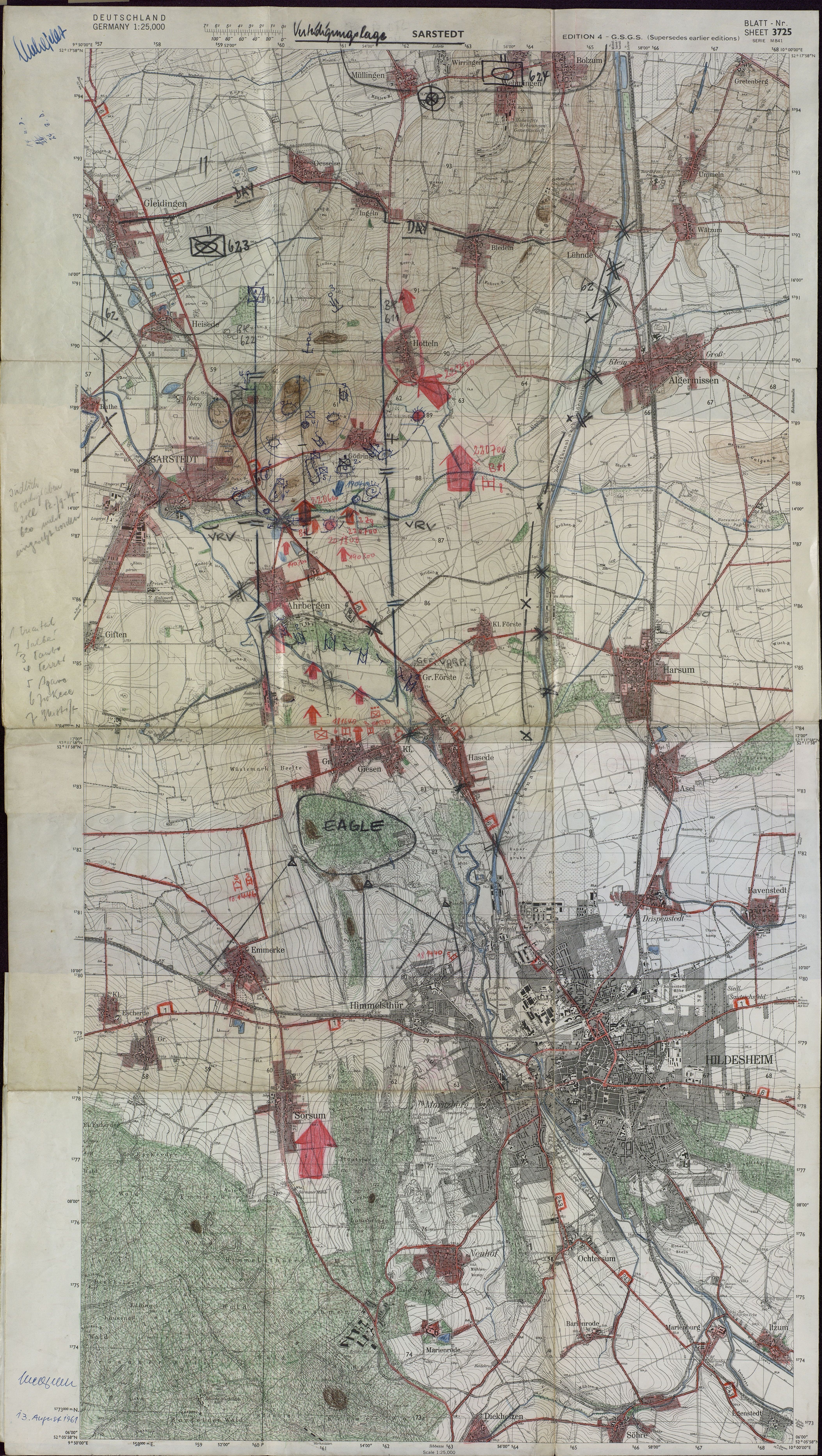
Dos mapas impresos en diversos colores por una sola cara. Multitud de anotaciones manuscritas, tanto a lápiz como en pinturas roja y azul.Dos mapas militares usados por los oficiales de la OTAN en las oficinas alemanas inmediatamente después de la construcción del muro de Berlín. El primer mapa se refiere al área de Hannover y Brunswick. El segundo mapa es un mapa de situaciones de defensa, y es más detallado. Ambos contienen marcados a mano en color rojo las posiciones enemigas y en azul las zonas de defensa, pero no son las posiciones reales que existían en ese momento, sino una forma de enseñar a los oficiales jóvenes los movimientos de guerra.
Appraisal, destruction and scheduling
Accruals
System of arrangement
Conditions of access and use area
Conditions governing access
Conditions governing reproduction
Language of material
- German
Script of material
Language and script notes
Physical characteristics and technical requirements
Medidas: 105,5 x 135 x 1 cm Conservación: Muy buena. Múltiples dobleces y arrugas.
Finding aids
Generated finding aid
Allied materials area
Existence and location of originals
Residencia de Estudiantes-Madrid
Existence and location of copies
Related units of description
Notes area
Note
"German military map". 13th August 1961
Alternative identifier(s)
Access points
Subject access points
Place access points
Name access points
- José María Castañé (Accumulator)