JMC_CP04_05325_001_001.jpg
Identity area
Reference code
FC-1-9-5325CP4
Title
Plano de la Retaguardia en la Guerra Civil Española, c. 1936
Date(s)
Level of description
Item
Extent and medium
Context area
Name of creator
Archival history
Immediate source of acquisition or transfer
Donación José María Castañé
Content and structure area
Scope and content
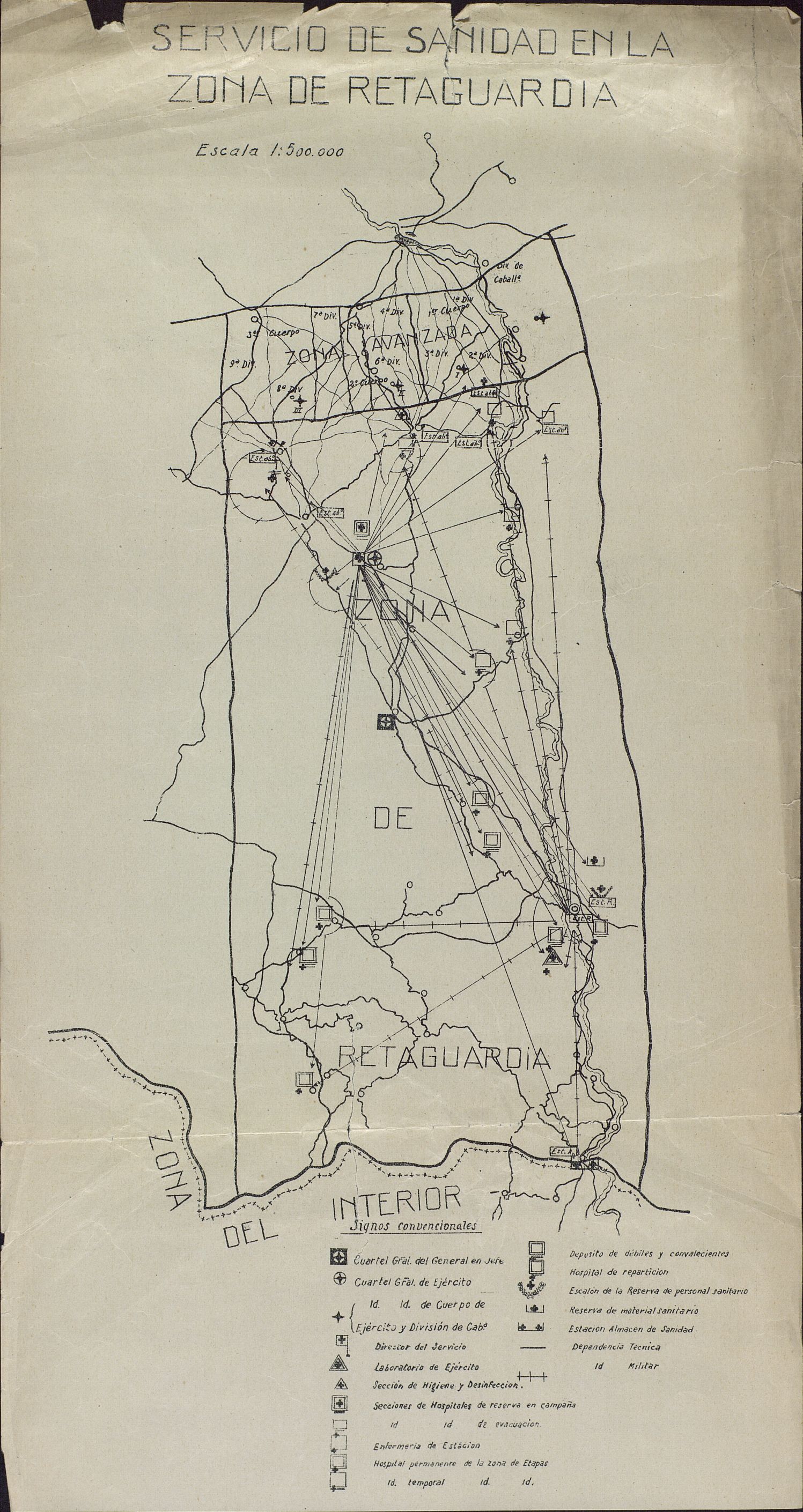
41 mapas de diverso tamaño y escala. La mayoría impresos en negro y algunos en color. 35 de ellos en francés, con un círculo en el que se señala "Guerre 1914-18 / Carte n.º ". Según esta numeración faltan los mapas: 4, 23, 25, 26, 27, 28, 29 y 30. Otros 5 croquis en castellano de Montero, Apuntes de Geografía militar de algunas potencias europeas, numerados en esq. sup. dcha. (1 repetido, 2, 3, 14). Otro en castellano: Servicio de sanidad de la zona de retaguardia.
Appraisal, destruction and scheduling
Accruals
System of arrangement
Conditions of access and use area
Conditions governing access
Conditions governing reproduction
Language of material
- Spanish
Script of material
Language and script notes
Physical characteristics and technical requirements
Medidas: 22 x 16 x 1 cm Conservación: Buena. Dobleces muy marcados, arrugas, manchas, algunas rasgaduras.
Finding aids
Generated finding aid
Allied materials area
Existence and location of originals
Residencia de Estudiantes-Madrid
Existence and location of copies
Related units of description
Notes area
Note
Plano de la Retaguardia en la Guerra Civil Española, c. 1936
Alternative identifier(s)
Access points
Subject access points
Place access points
Name access points
- José María Castañé (Accumulator)